
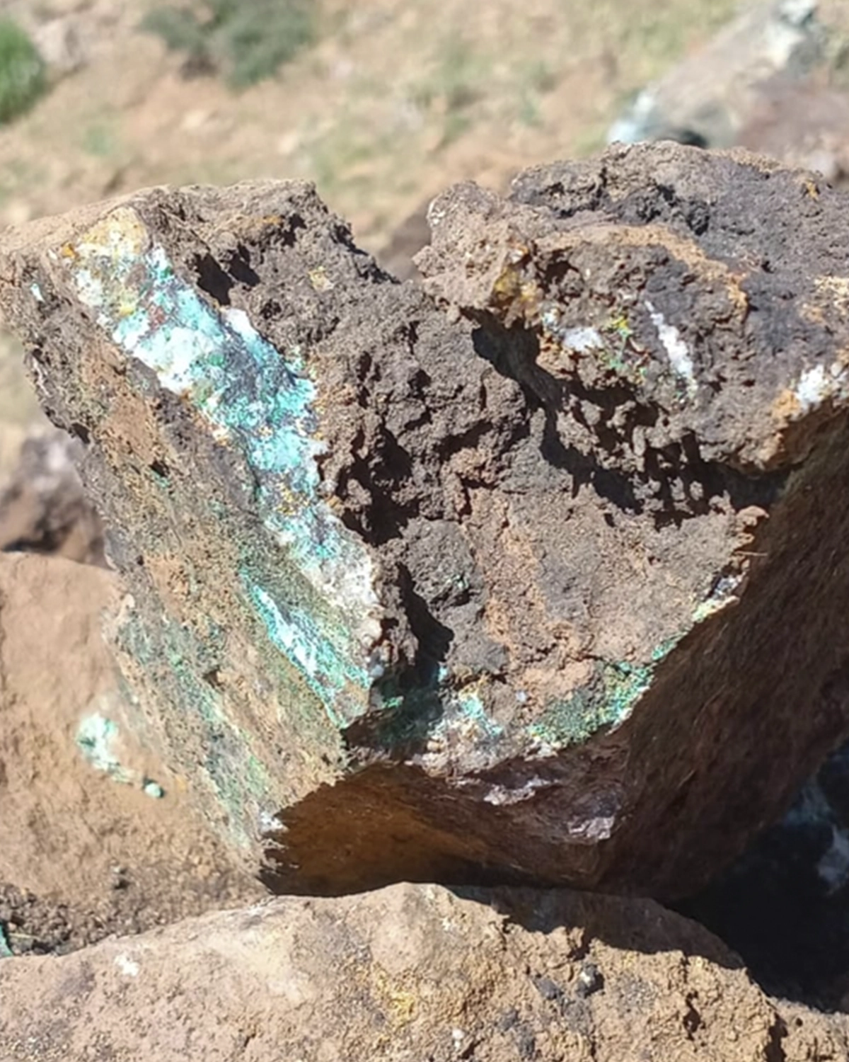
The Ourg Copper Project is a copper exploration permit located in the Western High Atlas of Morocco. Geological, structural, geophysical, and remote sensing studies have identified a hydrothermal system favorable for copper mineralization. The results have defined several priority exploration targets for future work.
Ourg Copper Project Overview
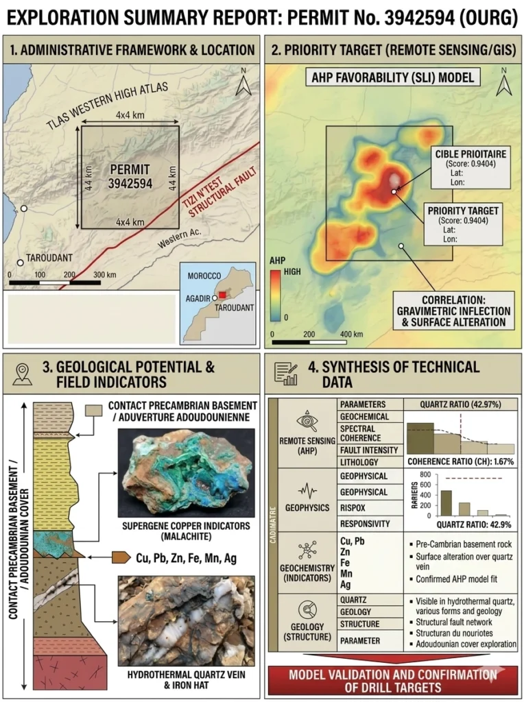
The Ourg Copper Exploration (Permit No. 3942594) targets a high grade hydrothermal vein and structurally controlled copper system. The project demonstrates significant vertical and lateral continuity. Located within a major tectonic extension of the Western High Atlas, the project is directly associated with International Mineral Occurrence No. 214.
Recent exploration using advanced Landsat 8 remote sensing combined with Analytical Hierarchy Process (AHP) modeling identified a Quartz Ratio of 42.97%. These results confirm a network of silica veins containing surface copper oxides, including malachite and chrysocolla. Deep gravity surveys also identified a major structural dilation zone beneath the central occurrence, indicating favorable conditions for a potential massive sulphide system containing chalcopyrite at depth.
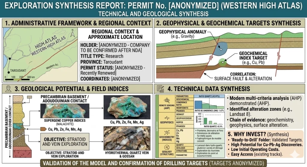
Ourg Copper Project Geological Setting and Structural Controls
Ourg Copper Project Lithostratigraphy
The Ourg Copper Exploration is located at the contact between two major geological units.
The deep basement consists of Precambrian III structural inliers composed of felsic volcanic rocks, rhyolites, ignimbrites, andesites, and related magmatic formations that represent the primary metal source.
The overlying sedimentary cover belongs to the Adoudounian Series, particularly the Lower Dolomite Formation. These carbonate rocks provide an ideal chemical environment for metal precipitation during hydrothermal activity.
Ourg Copper Project Structural Geology
The Ourg Copper Exploration is strongly influenced by the major Tizi N’Test Fault, one of the principal tectonic structures in the Western High Atlas.
A dense network of northeast southwest trending secondary faults crosses the permit area. Movement along these faults created shear zones and tectonic breccias that served as preferred pathways for hydrothermal fluids responsible for copper mineralization.
Ourg Copper Project Surface Mineralization
Field investigations identified several easily recognizable minerals exposed at the surface.
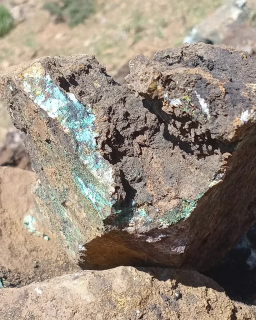
Abundant malachite, characterized by its bright green color, and chrysocolla, distinguished by its blue green appearance, represent the copper mineralization.
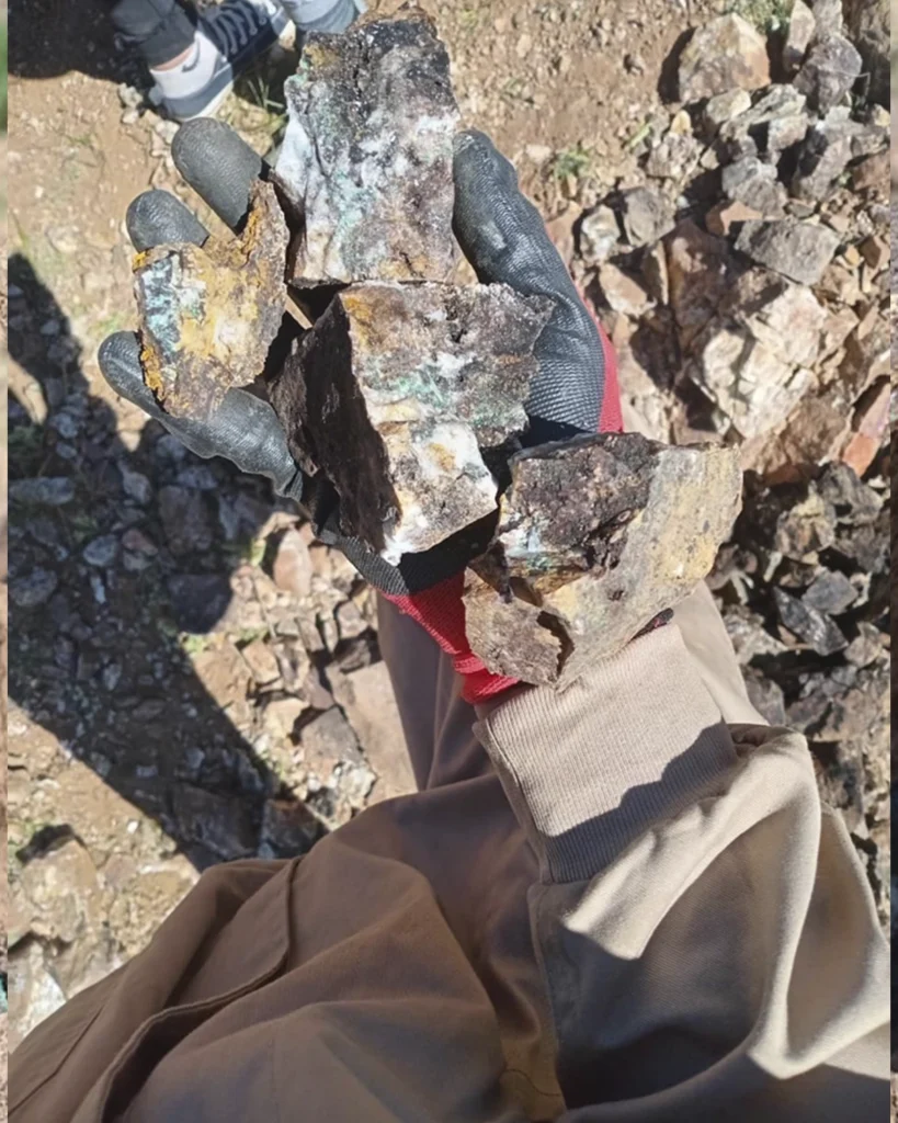
Iron and manganese oxides are also present. Limonite forms an oxidized iron cap above the quartz vein system. This feature provides additional evidence of hydrothermal alteration associated with the mineralized structures.
For more information about our mining projects and exploration services, visit Harizona SARL. Follow our Pinterest page for the latest project updates and geological insights.